


PHILADELPHIA WD 65 PCT 12, Philadelphia County, Pennsylvania
About
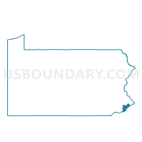
Outline

Summary
| Unique Area Identifier | 662322 |
| Name | PHILADELPHIA WD 65 PCT 12 |
| County | Philadelphia County |
| State | Pennsylvania |
| Area (square miles) | 1.32 |
| Land Area (square miles) | 0.88 |
| Water Area (square miles) | 0.44 |
| % of Land Area | 66.61 |
| % of Water Area | 33.39 |
| Latitude of the Internal Point | 40.02510120 |
| Longtitude of the Internal Point | -75.02166600 |
Maps


Graphs
Select a template below for downloading or customizing gragh for PHILADELPHIA WD 65 PCT 12, Philadelphia County, Pennsylvania


Neighbors
Neighoring Voting District (by Name) Neighboring Voting District on the Map
- Cinnaminson township voting district 1, Burlington County, NJ
- Palmyra borough voting district 9, Burlington County, NJ
- PHILADELPHIA WD 41 PCT 17, Philadelphia County, PA
- PHILADELPHIA WD 65 PCT 07, Philadelphia County, PA
- PHILADELPHIA WD 65 PCT 11, Philadelphia County, PA
- PHILADELPHIA WD 65 PCT 13, Philadelphia County, PA
- PHILADELPHIA WD 65 PCT 14, Philadelphia County, PA
- PHILADELPHIA WD 65 PCT 16, Philadelphia County, PA
- Riverton borough voting district 1, Burlington County, NJ
- Riverton borough voting district 3, Burlington County, NJ
Top 10 Neighboring County Subdivision (by Population) Neighboring County Subdivision on the Map
- Philadelphia city, Philadelphia County, PA (1,526,006)
- Cinnaminson township, Burlington County, NJ (15,569)
- Palmyra borough, Burlington County, NJ (7,398)
- Riverton borough, Burlington County, NJ (2,779)
Top 10 Neighboring Place (by Population) Neighboring Place on the Map
Top 10 Neighboring Elementary School District (by Population) Neighboring Elementary School District on the Map
Top 10 Neighboring Unified School District (by Population) Neighboring Unified School District on the Map
- Philadelphia City School District, PA (1,526,006)
- Cinnaminson Township School District, NJ (15,569)
- Palmyra Borough School District, NJ (7,398)
Top 10 Neighboring State Legislative District Lower Chamber (by Population) Neighboring State Legislative District Lower Chamber on the Map
Top 10 Neighboring State Legislative District Upper Chamber (by Population) Neighboring State Legislative District Upper Chamber on the Map
Top 10 Neighboring 111th Congressional District (by Population) Neighboring 111th Congressional District on the Map
- Congressional District 3, NJ (680,341)
- Congressional District 13, PA (674,188)
- Congressional District 1, NJ (669,169)
Top 10 Neighboring Census Tract (by Population) Neighboring Census Tract on the Map
- Census Tract 9891, Philadelphia County, PA (7,765)
- Census Tract 330, Philadelphia County, PA (7,645)
- Census Tract 326, Philadelphia County, PA (6,942)
- Census Tract 329, Philadelphia County, PA (4,089)
- Census Tract 7003.03, Burlington County, NJ (2,897)
- Census Tract 7001.03, Burlington County, NJ (2,839)
- Census Tract 7002, Burlington County, NJ (2,779)
- Census Tract 381, Philadelphia County, PA (833)